
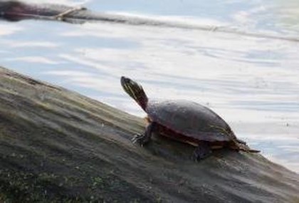
Studies have found that humans and wildlife (fish, mammals, birds, reptiles, and benthic communities) are at risk of experiencing negative health effects (risks) if they are exposed to the contaminated sediment in the harbour. Despite several decades of time for natural recovery, many areas have not recovered enough to be safe for current uses.
Most recreational activities in and around the harbour, like boating, kayaking, rowing, and hiking, are safe if skin contact with sediment is minimized or avoided. People should avoid touching the sediments and eating anything that may have touched the sediments. If sediment does contact your skin, simply rinse it off with site water or a shower and wash your hands before eating. Eating fish from the harbour is currently restricted. Information of fish consumption advisories in Ontario can be found using the Eating Ontario Fish guide (https://www.ontario.ca/page/eating-ontario-fish-2017-18).
Removal of the contaminated sediment is the best way to permanently reduce the risk of negative health effects. The need for removing contaminated sediment will be balanced with respect for the environment, especially in areas of sensitive or valued habitats. For example, the sediment will be removed when fish are not spawning and when turtles are not moving across the work area or overwintering. Sensitive habitats will be identified and considered carefully in the development of the sediment management plan and impact assessment.
The project team will be looking for opportunities for habitat conservation gains that will improve existing habitat and address present ecological impairments. Shoreline plantings of vegetation and other natural options for shoreline areas will be considered as part of detailed design.
The Detailed Impact Assessment (DIA) is being prepared, following requirements of the Canadian Impact Assessment Act and Parks Canada Impact Assessment Directive.
The DIA will find out if the project could cause significant negative environmental effects. Mitigation measures to stop or reduce negative effects will be identified and used. An environmental management plan will also be developed, and the project will be monitored to make sure that it is meeting requirements. The DIA will identify opportunities for improving habitat that is already impacted or not functioning properly for the wildlife. The DIA process will continue to incorporate Indigenous and stakeholder feedback received during detailed design.
In support of the DIA process, a Conceptual Constraints and Impact Considerations (CCIC) document has been prepared that provides a summary of potential project impacts to the natural and human environment that have been identified so far. It identifies the Valued Components (VCs) and the desired outcomes, thresholds, potential design considerations, potential constraints and information gaps for each VC. The CCIC helped inform the updated Sediment Management Plan and will be integrated into the DIA. The CCIC is available for download on the Documents page.
In addition to the CCIC, the DIA will use data and information from other documents previously prepared for this project such as the Biological and Ecological Inventories in Support of the Detailed Impact Assessment for Kingston Inner Harbour (SNC Lavalin, 2022), Conceptual Sediment Management Plan (WSP, 2023), and the What We Heard: Review of Public and Stakeholder Engagement, 2021–2022 (WSP, 2024). The DIA will build on existing information through additional literature reviews, fieldwork, and engagement/consultations.
Information gathered on wildlife and the environment during the DIA process will be used to inform the detailed design of the project, especially for the protection of sensitive species and their habitats.
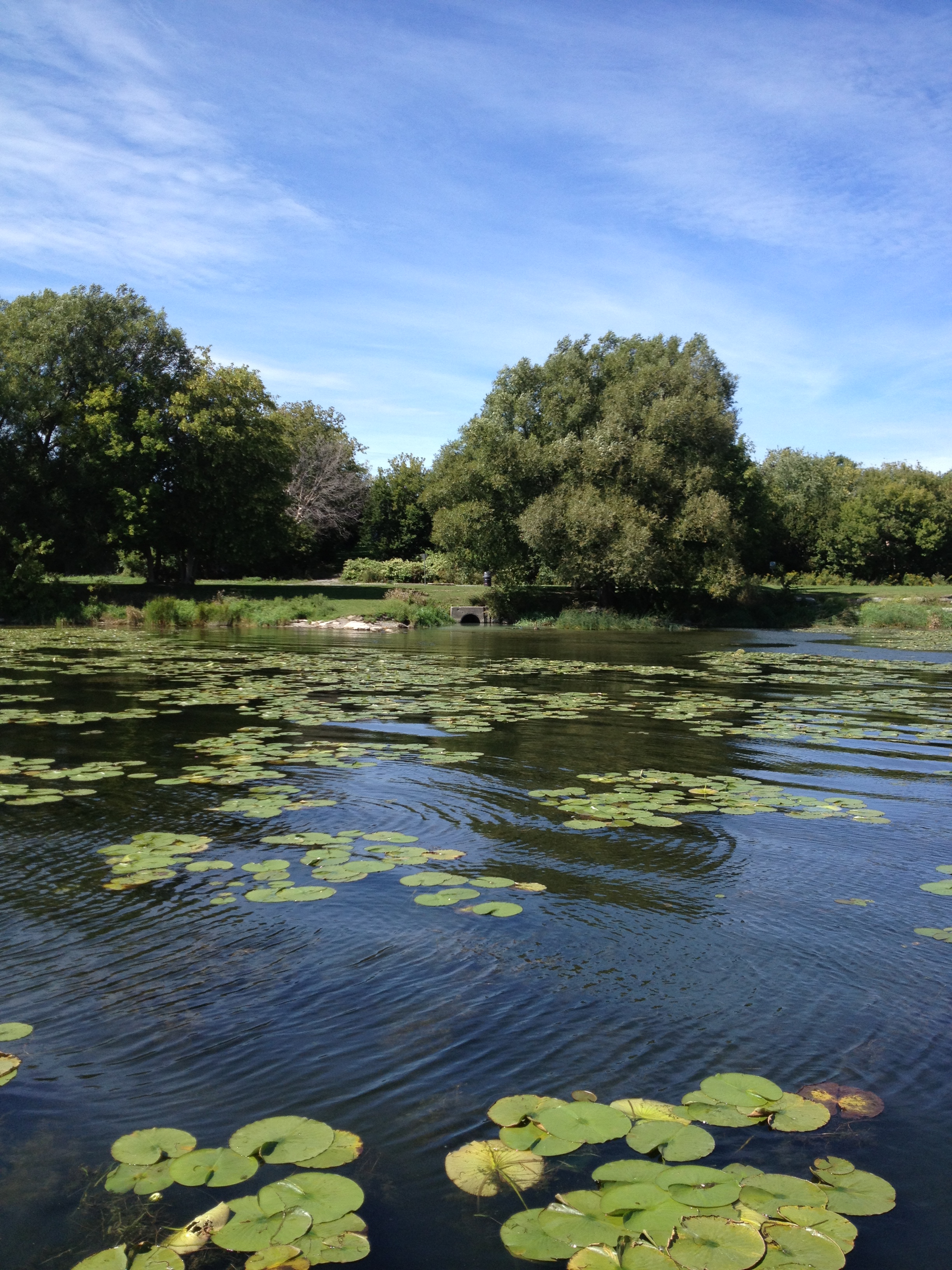
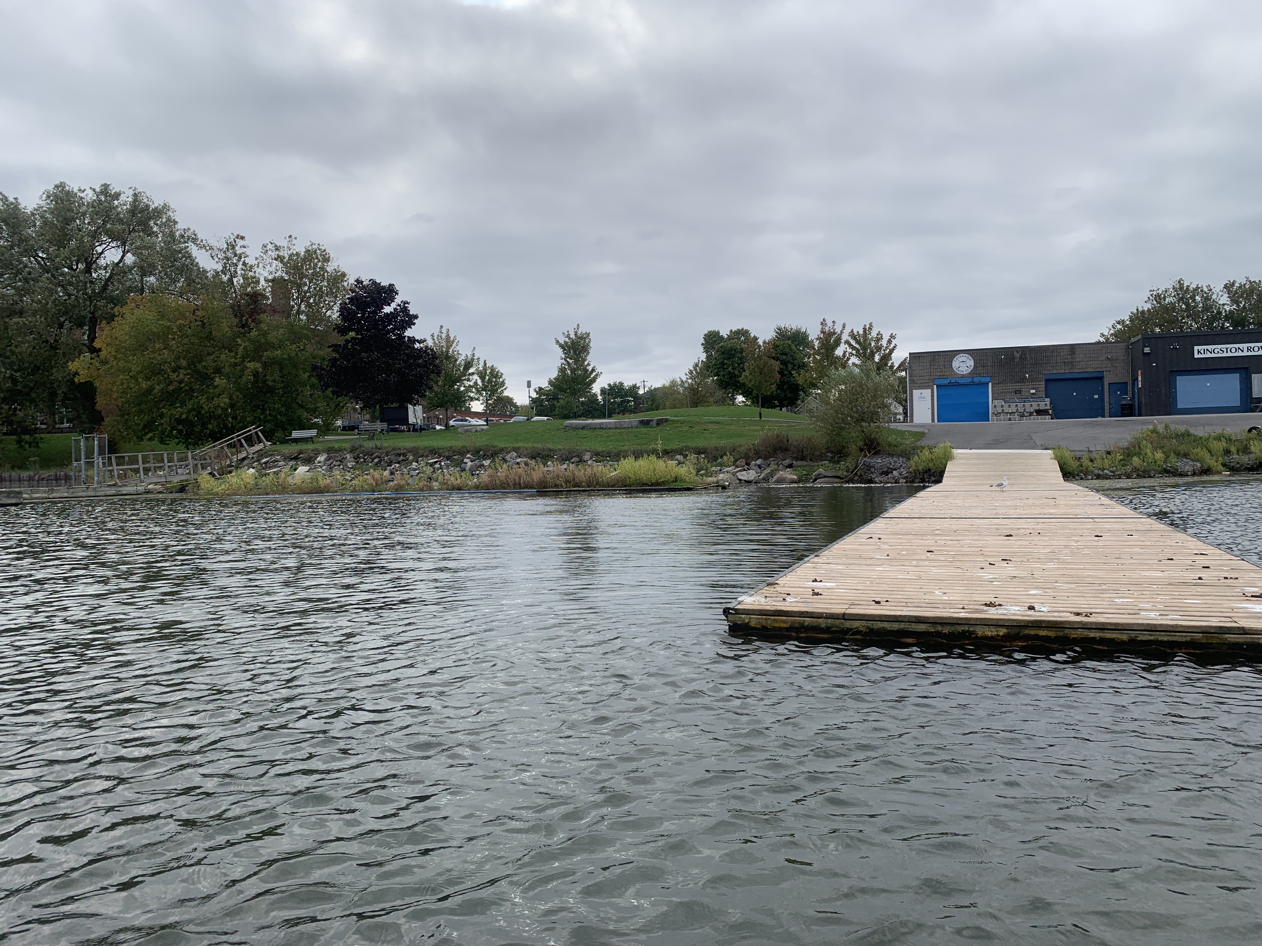
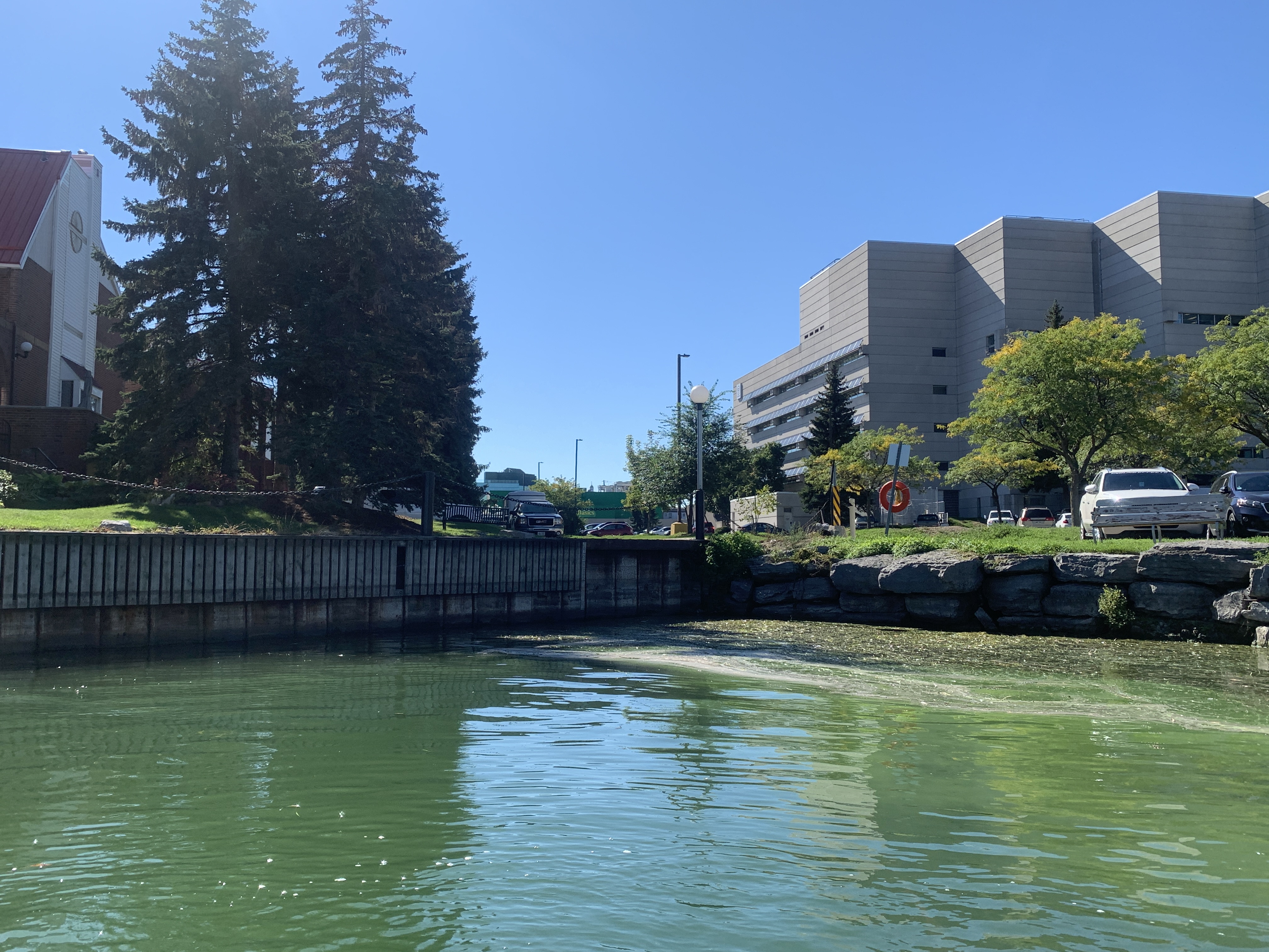
The term “risk” means there is a chance or probability of harm to people and/or the environment if they have been exposed to certain chemicals. It is called a risk because harm is possible, but it may not always happen, or may happen only to a small group of individuals. The risk level depends on the amount of exposure, pre-existing health, and other factors. An environmental risk assessment is a scientific process used to describe and estimate the chance of negative health effects (i.e., potential risks). Risk assessments tend to be conservative and err on the side of caution, as under-estimating the level of risk could have harmful consequences.
Risk refers to the chance or probability of an unwanted effect, so we are looking at the chance or probability of harm to people and/or the environment if they have been exposed to chemicals in the sediment. For humans, the main risks in the harbour are from exposure to PAHs and PCBs (metals are less of a concern, except possibly for methylmercury). High exposure to PAHs and PCBs may cause negative health effects in people. The main concern for exposure to PAHs is an increased risk of cancers, but for PCBs there are also concerns about effects to the immune system, reproductive system, the brain, glands, or organs. Exposure to metals, PAHs, and PCBs are all potential issues for wildlife (birds, mammals, reptiles, amphibians, fish, and benthic invertebrates). Effects of exposure to these chemicals can include poor development of young animals, deformities in adult animals, and potentially death.
Nearly all human activities have some risk. The study of health risk assessment is intended to measure those risks, so that regulators and the public can understand them better, and where necessary, can reduce those risks to an acceptable level. In deciding what levels of risk are acceptable, risk assessors first evaluate whether the risks are voluntary. Most people are willing to take on risk to their health when they understand the nature of the risks involved and when they can exercise some control over the degree to which they take on those risks. For example, the act of driving a car has a moderate risk, yet many people accept the dangers of driving because of the benefits of driving, their understanding of those risks, and partial control over those risks. Risks of chemicals/contaminants in the environment are treated differently because they are mostly non-voluntary and invisible.
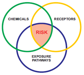
An environmental risk assessment is a scientific process used to describe and estimate the chance of negative health effects (i.e., potential risks) to humans and wildlife (e.g., birds, mammals, reptiles, amphibians, fish, and benthic invertebrates). These chemical risks can result from deliberately or accidently touching, breathing in, eating, or drinking contaminants at a site. For a risk to exist, three things must be true: 1. the amount of the chemical in the environment is high enough to potentially harm organisms 2. organisms that can eat or be exposed to the chemical must be present at the site; and, 3. there must be a way for the organism to have contact with the chemicals. When moderate or high risks (see definitions of risk categories below) are observed in an environmental risk assessment, clean-up and/or a risk management plan is required to address the risks so that people, and/or wildlife are protected.
Risk assessors categorize risks based on the level of threat to health. For human health, we look at the chance of a serious negative health outcome (e.g., cancer) or the degree to which a long-term chemical exposure exceeds a level considered by scientists to be safe. In ecological risk assessment, a similar approach is used, and focuses on health risks to communities of animals such as wildlife and their food. To help summarize risks, we often use terms such as “negligible risk”, “low risk”, “moderate risk”, and “high risk”. These categories summarize complex and detailed information into simple categories. Examples are provided below.
Negligible risk (safe for unlimited use): A risk that is so low that it can easily and confidently be concluded to be safe. For human health, this means that people can have unrestricted exposure to the site without increasing their risk in a meaningful way. For ecological health, negligible risk means animals are protected in terms of their survival or ability of grow, develop, or reproduce normally. As an example, negligible risk occurs when site contamination falls within the normal background levels for a chemical substance in water, sediment, and fish tissue.
Low risk (generally safe but with possible restrictions): A risk that is acceptable to nearly all users of the site. Exposure may exceed background levels or screening guidelines, but without causing any major threat to health. Under a low-risk condition, it is possible that a small number of individuals with very high exposure and high sensitivity could be affected. For this reason, controls may be required to keep risks low (e.g., a fish consumption advisory). For ecological risk assessment, low risk means that a small number of individuals of common species might have minor responses, but the populations and communities remain healthy, diverse, and productive.
Moderate risk (may be unsafe): A risk that is considered unacceptable in the long-term, based on the potential for damage to health. A moderate risk does not represent an emergency, or even definitive evidence of harm to health, but instead requires a careful plan to reduce exposure. For human health, moderate risk occurs when people consume more than a daily recommended intake of a substance. For ecological health, moderate risk means that adverse effects are expected to individuals of sensitive species, which may or may not result in a less healthy population.
High risk (clearly unsafe): A risk that is unacceptable, has clear evidence of negative health effects, and that requires fast action to reduce exposure. An example of a high risk that can occur in everyday life is contamination of meat or produce by bacteria such as Escherichia coli (E. coli). Under certain conditions, food products can be contaminated to a degree that requires a response from the Canadian Food Inspection Agency to protect public health. The same principle applies to contamination by chemicals, such that high risks from spills or concentrated areas of chemicals can require a fast response. For ecological health, high risk conditions can occur from an environmental spill, requiring prompt action to prevent widespread environmental damage.
The Project aims to reduce chemical risks to a level that protects both people and the environment, consistent with the standards used by the federal government for other contaminated sediment sites in urban harbours. To do this, some sediment will need physical intervention but it is not necessary to lower all chemical levels and areas to the strictest sediment guidelines. The goal is to focus cleanup where chemical risks are highest while ensuring the protection of wildlife habitats, archaeological, infrastructure, and recreational values. Cleanup will reduce chemical risks in the areas where physical intervention occurs and will also speed up the recovery of other areas over the long-term as sediments continue to move throughout the harbour. This balanced approach will also take into account values of Indigenous Groups, stakeholders, and the public.
There is no health emergency or need for urgent action. Risks to human health from harbor sediments are considered moderate, but not severe, and would continue for decades if not managed. Water quality remains acceptable and does not require management separate from the sediment management plan. If people do not eat a lot of local fish and do not have regular contact with the contaminated sediments, the risk is low. A fish consumption advisory is in place (https://www.ontario.ca/page/eating-ontario-fish). Most recreational activities in and around the harbour, like boating, kayaking, rowing, and hiking, are safe if skin contact with sediment is minimized or avoided. People should avoid touching the sediments (including contact through swimming). If sediment does contact your skin, simply rinse it off and wash your hands before eating.
For several decades, it has been known that Kingston Inner Harbour (KIH) had high levels of contamination due to historical industries and land uses. This process of assessing the environment in the KIH began over 20 years ago, to identify what locations and levels of contamination are present, where contamination is coming from, what the associated risks may be and, if necessary, what strategies are needed to manage unacceptable risks.
We know that the main upland sources of sediment contamination have stopped and/or have been controlled. These studies also show that the recovery of the sediment quality in the harbour has been slow or not happening in most areas, and some contaminated sediment continues to spread out into other sections of the harbour. Now that the environmental risks have been identified, under the federal process we need to take action to address the areas that are too contaminated to be safely left in place.
Letting natural processes continue (called monitored natural recovery) was considered throughout the Project and is the recommended approach for the majority of the Kingston Inner Harbour (KIH) where contamination levels are lower. If the results of sediment sampling at the site had shown strong evidence that natural recovery was happening over time, we would have proposed managing even more of the KIH sediments using monitored natural recovery. Unfortunately, in some areas, evidence from field sampling shows that natural recovery alone is not enough for sediment quality to recover over multiple decades. This has been confirmed by sediment samples from 2021-2024 showing that in the last 10-15 years, concentrations of chemicals have shown little change; there are still elevated levels of several chemicals, and associated health risks in near-surface sediment where animals live and feed. The risks vary in magnitude and type over different parts of the harbour, but there are multiple contaminants and sensitive groups affected under current conditions. This means that action is needed in these areas of higher contamination where natural recovery is not sufficient to control risks.
If these higher chemical levels were consistently buried deeper, and covered by a stable clean layer of material, this may also have allowed for more monitored natural recovery. Unfortunately, significant contamination remains; some of it is at the surface and at shallow depths. Natural processes in the harbour also cause sediments to move and mix from various activities including those by animals as well as wind, wave and ice action. These activities maintain high surface contamination despite upland sources being stopped or controlled for many decades. Recent field testing also confirms that sediments continue to move and mix around the harbour.
Because chemicals are present above safe levels and are not lowering over time, active sediment management is necessary. Taking targeted actions will reduce the chemical risks in key areas, improve conditions quickly, and will stop or slow the spread of contaminated sediment further out in the KIH. The balance between intervention and the disruption to the natural environment is being carefully considered in both the detailed project design and the environmental impact assessment.
No, you should not be worried if you have been swimming/recreating in the harbor. Most recreational activities in and around the harbour, like swimming, boating, kayaking, rowing, and hiking, are considered safe since contact with the sediment is minimized or avoided during these activities. People should avoid touching the sediments and eating anything that may have touched the sediments. If sediment does contact your skin while you are using the harbour, simply rinse it off and wash your hands before eating.
Seeing wildlife in the harbor does not mean that they are not being negatively affected by contamination. Although the presence of turtles and other wildlife in the harbour is a good sign that the sediment is not causing severe negative effects to wildlife in the short-term, it may be causing underlying health conditions or community-level impacts that may not be easily seen or observed in all of the population. Effects of wildlife exposure to metals, PAHs and PCBs can include poor development, decreased reproduction rates, deformities or tumors, and mortality. For example, physical abnormalities, such as skin tumors, have been seen in some brown bullhead fish in the harbour that are likely caused by contact with the sediment.
Yes, most recreational activities in and around the harbour, like swimming, boating, kayaking, rowing, and hiking, are safe if skin contact with sediment is minimized or avoided. People should avoid touching the sediments and eating anything that may have touched the sediments. If sediment does contact your skin, simply rinse it off with and wash your hands before eating. Consumption of fish from the inner harbour is not recommended, and anglers are advised to consult the Guide to Eating Ontario Sport Fish (www.ontario.ca/environment-and-energy/eating-ontario-fish) for identification of areas in the Kingston region where consumption risks for fish flesh are lower.
Contaminated sediment will be safely removed by using standard and acceptable environmental controls and practices. Dredging is a safe and common practice for removing contaminated sediment and has been effectively done in harbours throughout North America. Dredging can be done by using a closed bucket to prevent losing sediment as it is brought up, or through suction dredging using a vacuum-like pump to remove the sediment. As part of the detailed design process, technologies best suited to each area to minimize negative impacts will be selected, and an environmental management plan will be prepared. The environmental management plan will describe how project activities can be conducted safely and what environmental controls must be in place during the project to prevent any accidental environmental effects, such as water or sediment quality impacts, physical danger to wildlife, or damage to archaeological values.
The environmental management plan (to be prepared as part of detailed design) will outline measures to prevent resuspended sediments (i.e., sediments that move from the bottom of the harbour into the water column) from spreading to other areas of the harbour or beyond. Typically, this includes the use of sediment curtains (i.e., physical barriers placed around the areas that are being dredged) at all times when dredging is occurring. The environmental management plan will also require that water quality meet background ranges and/or approved water quality guidelines for the protection of aquatic life outside of the areas actively being dredged. Environmental monitoring and sampling for water quality will be done during dredging to verify that the above conditions are met. These measures, which combine engineering approaches with best management practices, are commonly applied in sediment excavation and capping projects and have been shown to be effective at containing resuspended sediments.
Yes, many similar projects have been done in the past. You can find information on those projects using the links below. Dredging, which is the method we will be using in the harbour, is a standard and reliable technique for removing contaminated sediment. It has been used to clean-up hundreds of aquatic contaminated sites in North America. Examples of recently completed successful clean-ups of aquatic contaminated sites using dredging include:
The Kingston Inner Harbour Sediment Management Project does not include dredging in the Orchard Street Marsh, which is recognized as a highly sensitive area and part of the Provincially Significant Greater Cataraqui Marsh wetland. Instead, the proposed plan for Orchard Street Marsh entails low intervention marsh rehabilitation (i.e., no dredging or capping options) and will be limited to Enhanced Natural Recovery (ENR). An example of this ENR method is the placement of very fine layers of binding materials (like activated carbon) that will cause the chemicals in wetland sediment to be less available to aquatic organisms – thus reducing ecological risks. Since this layer is very thin and can be applied from a distance, its is expected to have very little impact on existing vegetation and ecological communities.
Beyond the federal water lots, there are additional areas of contaminated marsh sediment that are not part of this Project. There are opportunities for long-term collaboration with other parties that own or manage these adjacent portions of the provincially significant wetlands. The activities for the federal water lots are being designed to allow for compatibility with environmental management of those other areas so that risks might be further reduced over the longer term.
The depth of contaminated sediments requiring dredging varies across the harbour, because the soft, silty sediments that contain the contamination varies in thickness. The thickness in each management unit has been evaluated using tools such as ground penetrating radar and additional subsurface coring. Over much of the harbour, the thickness of contaminated soft sediment is less than 1 metre, but there are areas where deeper excavations are needed. Below the soft sediment lies a native lake clay layer that is not contaminated because that material was deposited long before the pollution happened. Samples have confirmed that this underlying clay layer is clean and provides an excellent marker horizon to indicate the limit of dredging depth needed. It is currently estimated that approximately 69,500 m3 of sediment will need to be dredged from the KIH (Stage 1 - 17,500 m3 and Stage 2 - 52,000 m3), but this volume continues to be refined as engineering design work progresses.
The project team is still deciding where the removed contaminated sentiment will go and how it will be transported there. These details will be developed further during the detailed design phase. Generally, excess water from the dredged sediment will first be removed (i.e., dewatered) so that it is more stable to transport and then will likely be transported by haul trucks to approved and regulated landfills for disposal. The dredged sediment may also be stabilized and solidified to bind the contaminants in a solid form, and make the material more easily transported by trucks and/or barges. Any excess water generated during this process will be tested and treated if necessary. Disposal facilities, once selected, will hold a valid permit, license, certificate, approval, or any other form of authorization issued by a Facility Regulator (i.e., federal or provincial government) for the handling and disposal of contaminated or Hazardous Waste Quality Materials (if required). As part of the detailed design and impact assessment process, an environmental management plan will be prepared to make sure that the material is appropriately transported and disposed of.
“Ex situ” means off site; any sediments dredged from Kingston Inner Harbour (KIH) would be permanently removed and safely disposed of at an approved, permitted landfill outside the Project area.
“Sediment disposal” is the main method of sediment removals for the Project and entails transport by truck of dewatered sediments from KIH directly to a permitted landfill; no sediment treatment is required for these materials provided that the dredged sediments, called dredgeate, meets the landfill operator’s criteria for chemical and physical parameters. The specific location (destination) of the landfill(s) has not been prescribed, but any option must satisfy provincial requirements for safe landfill disposal. The requirement for any special treatment or disposal methods will be evaluated by taking additional chemical measurements and/or conducting leachability tests prior to off-site transport.
“Sediment treatment” applies a process to destroy, or remove exceptionally high levels of contaminants from dredged sediments so that they can be disposed of using conventional landfills. Most of the sediments in KIH will not need this type of treatment because they are not expected to have contaminant concentrations that would classify them as “hazardous waste”. Sediment treatment would only be needed if pockets of hazardous wastes are identified during the project. Treatment, if needed, would only be conducted at a special facility, such that no dust, vapours, or poisons that pose potential health risks would be generated. There is a possibility that some excavated coal-tar contaminated sediments near Anglin Bay may require treatment, but these would be limited to small volumes of material (called free product) derived from the legacy coal gasification source(s).
A Detailed Impact Assessment (DIA) will be completed, consistent with Parks Canada’s Impact Assessment Directive and the requirements of the Canadian Impact Assessment Act (https://laws.justice.gc.ca/eng/acts/I-2.75/index.html), to determine whether any aspects of the recommended plan would be likely to cause significant adverse environmental effects. The DIA will consider potential changes to the environment that are likely to be caused by the Project; technically and economically feasible mitigation measures that would prevent or minimize adverse effects; and, the impact that the project may have on the rights of Indigenous Peoples. The DIA will include a summary of formal consultation with Indigenous communities and a public comment period. The Detailed Impact Assessment may result in further design changes if it is found that there is the potential for significant negative effects on the environment from the current proposed project. The need for removing and/or containing chemicals will be balanced with respect for the environment, especially in sensitive areas. It is recognized that some of the areas contain features or habitats of greater sensitivity, such as shipwrecks of archaeological value, wetland and marsh areas, or shoreline areas used by turtles, birds, and other wildlife for nesting, feeding, and basking. The conceptual sediment management plan has been updated to recognize these sensitive areas and proposes different, and less intrusive, methods for sediment management based on the current information. However, more detailed biological and ecological studies are being done as part of the DIA process to finalize the sediment management methods.
In support of the DIA process, a Conceptual Constraints and Impact Considerations (CCIC) document was completed (SNC-Lavalin 2023) to provide preliminary high-level considerations of potential impacts from the project based on information gathered to date.
The need for removing chemicals will be balanced with respect for the environment, especially areas of sensitive or valued habitats. It is recognized that some of the shoreline areas contain habitats of greater sensitivity, such as wetland and marsh areas, or shoreline areas used by turtles, birds, and other wildlife for nesting, feeding, and basking. The conceptual sediment management plan recognizes these sensitive areas and proposes different, less intrusive, methods for sediment management, including nature-based shoreline solutions. In some areas, dredging will be excluded entirely to avoid unacceptable alteration of habitat. There will also be habitat gains through this project in the restoration of shorelines or other low value habitats. The methods being proposed to protect sensitive species, habitats and valued features are provided in the updated conceptual sediment management plan and will be evaluated in detail during the impact assessment.
The federal government has been conducting fish habitat surveys to document sensitive habitat features. In addition, the team is using a Habitat Ecosystem Assessment Tool (HEAT) to scientifically assess and predict the net change in habitat productivity. The HEAT model combines information on fish habitat inventory with habitat requirements specific to critical life stages; it was developed to evaluate proposed development project effects on fish habitat and has primarily been applied in the Great Lakes region. The Project will follow a “no net loss” guiding principle (to achieve no net loss of the productive capacity of aquatic habitats) for any of those spawning species, and the assessment will be included in the Detailed Impact Assessment for Kingston Inner Harbour, which contains sections specific to fish and fish habitat.
The Project team is engaging with Fisheries and Oceans Canada, the Ministry of Natural Resources and other environmental agencies to ensure the necessary permits, approvals, and guidance for the Project are met.
Removal of the contaminated sediment using the proposed methods is the best way to permanently reduce health risks. The need for removing chemicals will be balanced with respect for the environment, especially areas of sensitive or valued habitats. For example, the sediment will be removed when fish are not spawning and when turtles are not moving across the work area or overwintering. An initial assessment of sensitive habitats and ways to avoid harm to these habitats is included in the conceptual sediment management plan, and will be evaluated in detail during the impact assessment and detailed design.
The current sediment management plan includes the use of dredging exclusion zones (areas where sediment will not be removed) along the shoreline to preserve the integrity of shorelines, sensitive habitats, and archaeological features in some areas. There may also be habitat improvements because of the planned nature-based shoreline rehabilitation along the inner harbour. This will include shoreline plantings that will preserve ecological habitat (including turtle habitat) and prevent/reduce erosion.
We will do as much as possible to reduce the negative effects of this project to local businesses. As part of the project planning and stakeholder engagement process, businesses operating in the harbour will be contacted to ensure the project team has a good understanding of their operational needs, so that potential impacts to operations associated with the project can be identified and managed.
This information will be incorporated into detailed design and project implementation plans. Given the project is still in the planning stages, exact schedule and impact to business operations are still unknown; however, we will work with business operating in the harbour to minimize and/or eliminate impacts to their operations.
No, drinking water in downstream areas will not be an impacted by this project. Sediment management projects such as these are very safe, and the technologies being proposed (such as dredging) are common practice for removing contaminated sediment from harbours. The project will use appropriate environmental controls such as sediment curtains, and environmental monitoring, including taking measurements for water quality and sediment quality outside of the dredging areas, will also be conducted to confirm that chemicals harmful to people, or wildlife are not spread into other areas of the harbour or into Lake Ontario where most of Kingston’s drinking water comes from.
The project team is still deciding how often and for how long the harbour will be monitored after sediment management. Details of the monitoring program will be developed as planning progresses. Federal monitoring programs for this type of work typically involves intensive daily monitoring during project implementation to make sure that it is following the project’s prescribed environmental protection plan, followed by short-term yearly monitoring (~1–5 years) and a long-term monitoring component (~10+ years) that happens less often (e.g., every few years) to confirm that habitat restoration has been successful and that sediment management goals continue to be met.
As part of the project planning and stakeholder engagement process, businesses operating in the harbour will be contacted to ensure the project team has a good understanding of their operational needs, so that potential impacts to operations associated with the project can be identified and managed. This information will be incorporated into detailed design and project implementation plans. Given that the project is still in the planning stages, exact schedule and impact to business operations are still unknown; however, we will work with business operating in the harbour to minimize and/or eliminate impacts to their operations.
No, dredging will not be conducted year-round. For projects of this type, dredging must respect timing windows to protect sensitive biological stages of fish, reptiles, and other animals that may be present. Dredging is based on a tentative five-month window – May to September, inclusive. These windows may be refined based on individual water lot habitat features as part of the Detailed Impact Assessment (DIA) and in discussion with other regulators like Fisheries and Oceans Canada and Environment and Climate Change Canada. These windows will be tailored depending on the sensitivity of the management unit.
No, dredging will not threaten the local drinking water supply. Several environmental protection measures will be implemented to protect water quality during the project. Heavy-duty turbidity curtains (or similar isolation measures) will be used to isolate the work areas and protect against sediment releases; these turbidity curtains are floating barriers that are weighted at the bottom to contain sediment that is stirred up by in-water activities. The project’s environmental management plan will provide specifications for controlling sediment-laden water, including performance measures for dredging within the work zone, environmental monitoring outside the work zone, and water quality standards prior to discharge of water to Lake Ontario through the LaSalle Causeway.
The water quality during the Project will be best managed by controlling turbidity. Turbidity curtain performance is well understood in Ontario conditions and will include lessons learned from the Waaban Crossing Project just north of Kingston Inner Harbour (KIH). As part of the federal Detailed Impact Assessment for KIH and the ongoing detailed design process we are setting site-specific water quality criteria. Real-time water quality monitoring will be used to ensure that these thresholds are not exceeded outside of work areas during project activities.
We are also taking extra steps to verify, through water quality modelling, that there would be no risk to the City's water supply in the unlikely event that there was a failure of sediment containment measures during the work. This modelling, in conjunction with the implementation of environmental controls during dredging, and downstream monitoring of water quality will ensure the protection of drinking water. During project implementation, adaptive management controls will be applied, including strict controls for contractors to shut down work if water quality thresholds are exceeded immediately outside the isolated work areas.
Have more questions? Please visit the Q&A page for the project for the full list of questions and answers.